Marion County Watershed Management Plan  Orange Creek
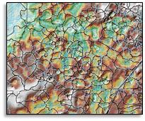
Tillman and Associates Engineering served as the design team for the Marion County Orange Creek Watershed Management Plan (WMP) project. The development of the WMP was based on Southwest Florida Water Management District’s (SWFWMD) Guidelines and Specifications documents. The Orange Creek Watershed is approximately 47,520 acres (74.25 square miles) in size and is located in north Marion County, Florida. The purpose of this project was to develop a hydrology/hydraulic geodatabase for stormwater modeling and floodplain elevation determinations.
The initial project phase was to review and identify topographic voids in the existing Digital Terrain Model. Topographic voids were then verified by field reconnaissance and/or review of existing Environmental Resource Permits. A Survey Needs Evaluation was also performed for the watershed by compiling a geodatabase of existing storm pipes and control structures. The hydraulic structure locations were identified by visual inspection of imagery and the Digital Elevation Model, review of ERPs and as-built plans, review of municipality stormwater asset data, and field reconnaissance.
The second phase of the project consisted of the development of the model specific features. A separate subbasin was generated for each depressional area one acre in size, or greater, and with a depth of two feet or more. The resulting Basins, Nodes, Links, Channels, and Weirs were loaded into the Geographic Watershed Information System (GWIS) as preliminary model features. The second phase also included geodatabase parameterization using ArcHydro tools and HEC-RAS 4.1. Parameterization activities included: subbasin area quantifications for imperviousness and DCIA, soils parameters, subbasin stage and incremental area calculations for storage volumes, channel cross-sections, pipes, and drainage control structures. Once parameterization was completed, model specific tables were populated in a separate geodatabase for direct import into ICPR for stormwater modeling
Project team coordination responsibilities throughout the WMP development process include: weekly progress meetings, quarterly meetings with Marion County staff, milestone development for intermittent deliverables review, pre-deliverable meetings with Marion
County staff, and project coordination and responses with third party peer review.
GIS Watershed Management Project
The Watershed Management Program provides the methodology to evaluate the capacity of a watershed to protect, enhance, and restore water quality and natural systems, while addressing flood protection. The program measures effectiveness of the recommended strategies and goals to reach the desired watershed condition through assisted decision making using data analysis, modeling, projection and evaluation. Performance of professional services in accordance with the Southwest Florida Water Management District’s Watershed Management Guidelines and Specifications, and Federal Emergency Management Agency’s Guidelines and Specifications for Flood Hazard Mapping Partners are required.
Watershed Evaluation is the systematic inventory and assessment of the water resource features for gaining and understanding of the complexity of a watershed. It consists of several tasks related to the creation of a Geographic Information System (GIS) database that will contain information about the water resource features of the watershed. Data collection and management will be facilitated so that downloading of key stormwater inventory into the Marion County asset management database, Cartegraph, can be achieved.
